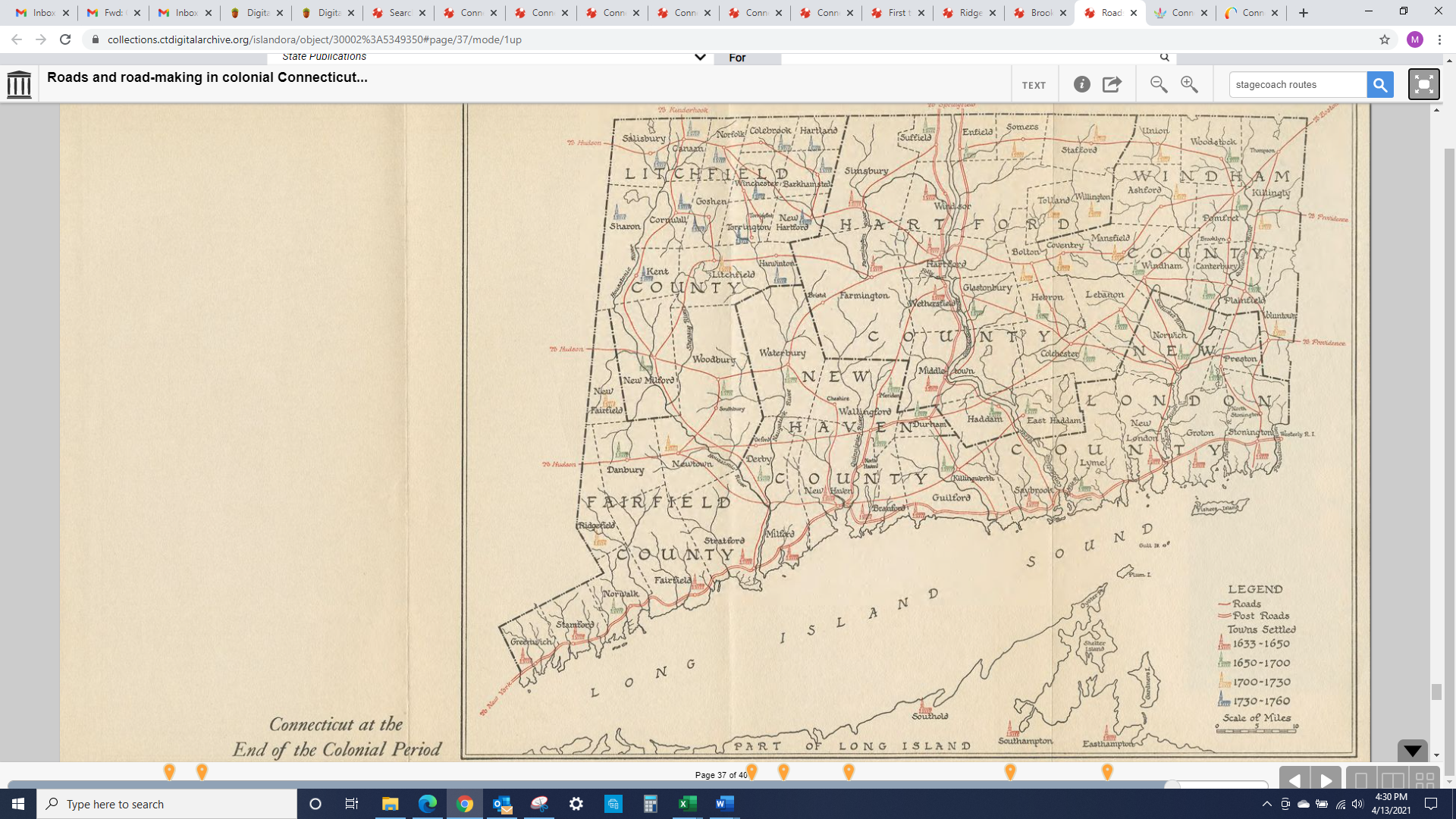
 Here's a map of former, major stagecoach routes and major inter-town highways in CT. The map is not exhaustive, but it shows CT before many "newer" towns were formed/incorporated and gives a good sense for how development was prioritized.
CalligrapherDizzy201 t1_iuhk26n wrote
Reply to comment by Personal-Ad-7407 in Here's a map of former, major stagecoach routes and major inter-town highways in CT. The map is not exhaustive, but it shows CT before many "newer" towns were formed/incorporated and gives a good sense for how development was prioritized. by CTHistory42
An infuriatingly tiny part of Wethersfield is between East Hartford and Glastonbury. You can walk through it on the Goodwin University river trail.
Personal-Ad-7407 t1_iuhr8fd wrote
Interesting!
That is a strange jog in the border. I checked the Wethersfield GIS map to be sure it wasn’t a Google Map artifact. Great trivia question material.
CalligrapherDizzy201 t1_iuhrr39 wrote
It’s really cool to walk through the woods and see an East Hartford/Wethersfield town line sign followed, about a half mile later, by a Glastonbury/Wethersfield town line sign. There’s even a reason for it but I don’t remember what. I’ll go look and update.
ETA: https://www.realhartford.org/2019/09/18/east-of-the-river-to-wethersfield/
Turns out it was a flood. This is a cool article about the area.
Viewing a single comment thread. View all comments