 A sight for sore eyes after the last few weeks here in the Snoqualmie Valley
Submitted by Twin_Peaks_Townie t3_ybrzxg in Washington
Twin_Peaks_Townie OP t1_itifjlg wrote
Reply to comment by zombieinferno in A sight for sore eyes after the last few weeks here in the Snoqualmie Valley by Twin_Peaks_Townie
Yup, the lack of rain is very concerning. My original intent with getting this picture was to capture the water level on the day the rain came back and do a comparison in a few weeks when we normally have flooding.
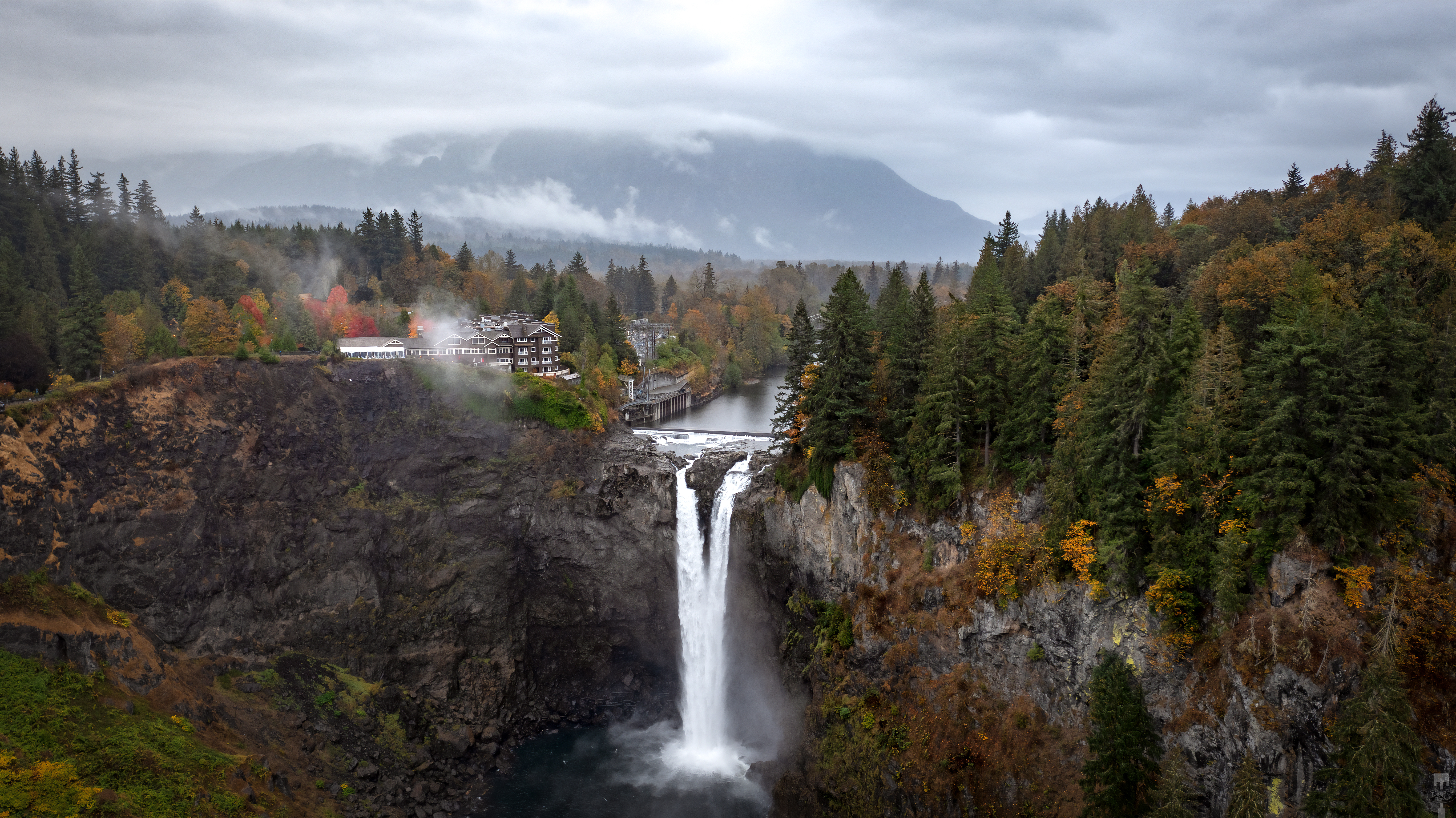
Here's a shot that I got on March 1st when we were at peak waterflow.
The Salmon obviously will never make it up the falls with or without the hydroelectric plant being there, but the water flow is a benchmark to measure the health of Washington Cascades. If the water flow for the Snoqualmie River (which is fed from as far north as Lenox Mountain, and as far east as Snoqualmie Pass), only produces this little amount of water over the falls, then our beautiful forests and the wildlife are in for big trouble in the coming years.
wpnw t1_itjs2a4 wrote
Keep in mind that the Snoqualmie River may have a large drainage area, but its a relatively low elevation basin with almost no glacial ice serving as its sources - the Overcoat Glacier is the only one of significance, and it's not very significant in the first place, and only about half of it flows into the Snoqualmie (the other half goes east into the Cle Elum River).
There are a couple tiny glacial remnants (basically stagnant but permanent ice) around too, but the rest of the Snoqualmie drainage sources in lakes or runoff, so when its been as dry for as long as it was this summer, it will of course suffer.
It's not really a good bellweather for the health of the rivers in the Cascades though, since other than the Skykomish and Stilliguamish, all of the other major rivers on the west side are fed by a ton of glaciers, and will be plenty healthy for a long time still.
Twin_Peaks_Townie OP t1_itjxgk1 wrote
You have some good points about how other areas of the cascades have glacial reserves to keep the rivers flowing, but the point that I was making is that this is the point that you can see and measure what the available water still is on the soil, since almost everything coming in has not been replenished since the end of June.
It’s not a “point of no return”, but it’s a reasonable benchmark to see how long and intense our summers are by how low the water flow is at Snoqualmie Falls at the end of summer.
Viewing a single comment thread. View all comments