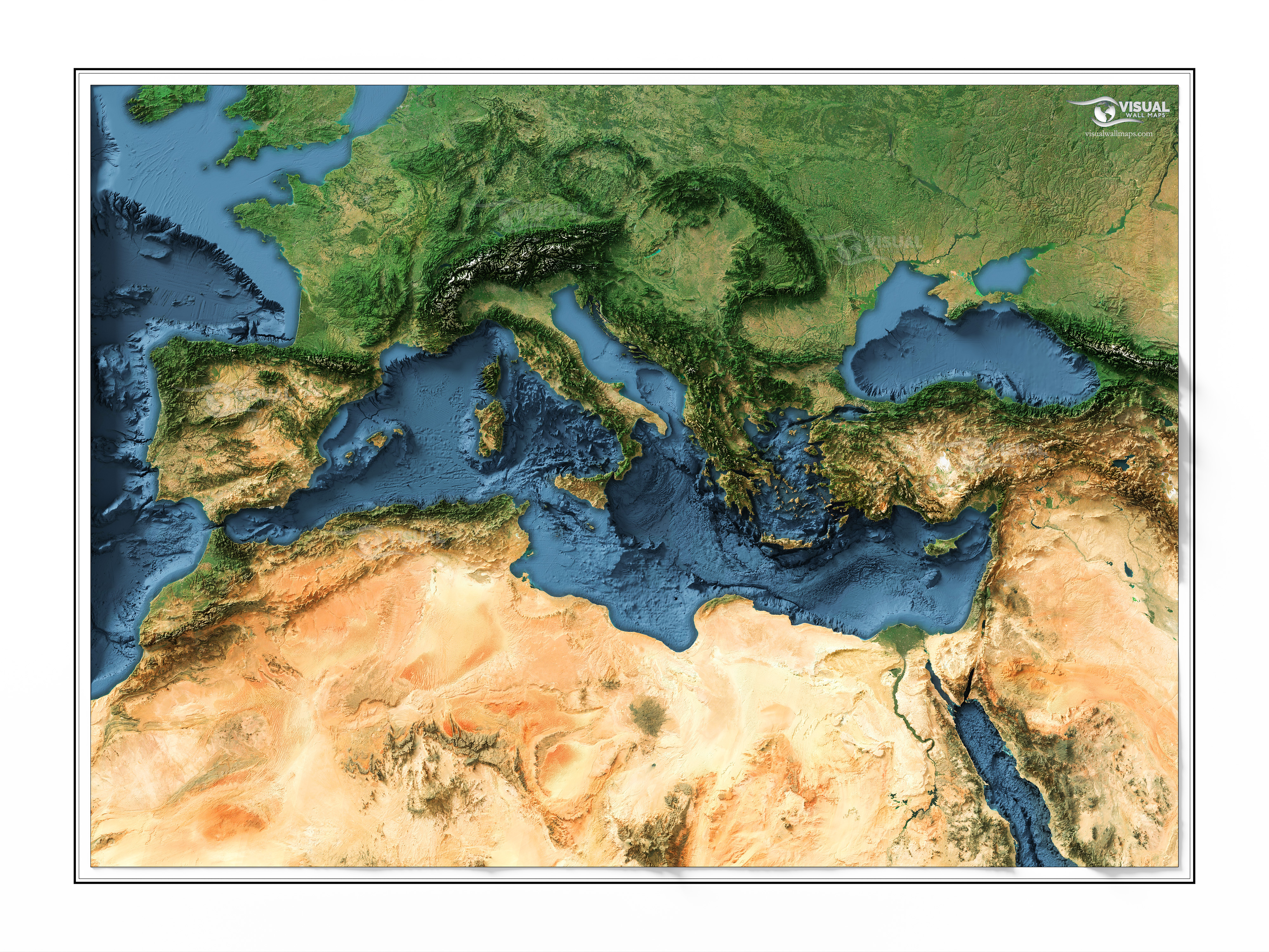
 A shaded relief map of The Mediterranean Sea Region rendered from 3d data and satellite imagery [OC]
visualgeomatics OP t1_jb5nt78 wrote
Source: GEBCO DEM, Sentinel-2 satellite imagery
Tools: Blender, QGIS, Global Mapper, Photoshop
Description: I combined sentinel-2 imagery with surface model data to cast light on it and create a pretty image that looks 3d. The map has lots of vertical exaggeration to bring out the topography, and I've coloured in the water, otherwise the image is a natural colour representation! Check out other examples on my instagram
djryanash t1_jb9itg8 wrote
Excellent work. Tell me, which Reddit should I join if I wanna see more of these types of maps and get info on how to make them? I’m trying to create a beautiful user experience with custom maps in Mapbox for iOS but it needs to be real-time rendering and have been experimenting with QGIS over the past for days with data from GEBCO.
Technical-Till-6417 t1_jbb71rm wrote
Well done, I love it.
Viewing a single comment thread. View all comments