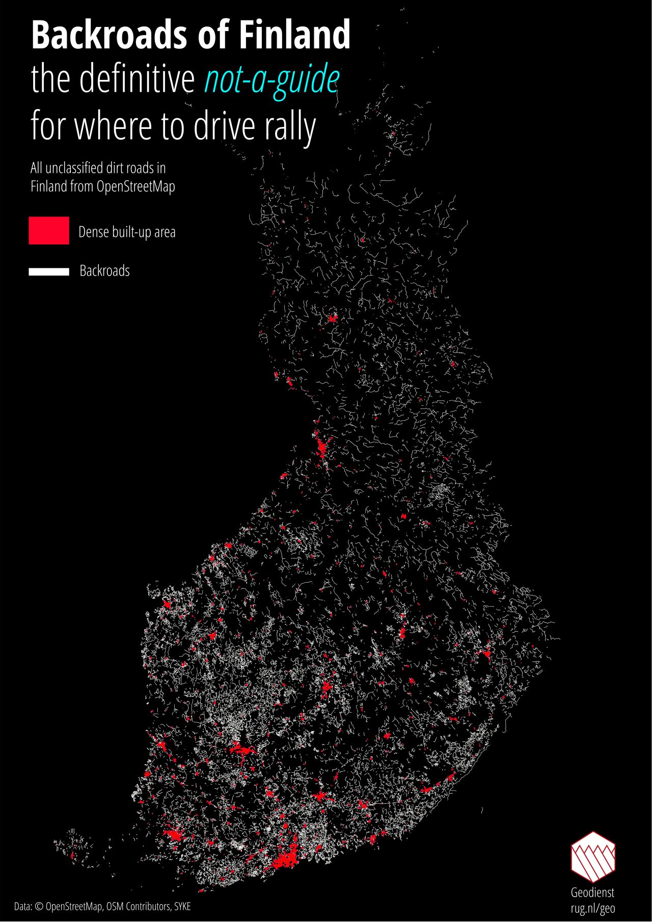
 [OC] A map of the backroads in Finland, perfectly captured by OpenStreetMap and visualized with QGIS. This map is a definitive not-a-guide to rally driving in Finland!
tilcica t1_j63lwbk wrote
why is there so many random patches of road not connected to anything? if the car went to capture there, why didnt it also capture the way there and/or back?
is it similar to germany where they had to remove large parts of it?
Wang_entity t1_j63ui9b wrote
I think this map had removed all of the main roads.
Kharon8 t1_j63wcuu wrote
Yes. All of those are gravel roads, so even minor paved roads aren't in the picture. I think this pic is also based on satellite images, so no car has visited those.
Even Google Maps doesn't show all gravel roads, but when they do, it looks like this: https://goo.gl/maps/6ehKRyfYjy3jzhX56
,,,,and typical rally speed on that: 100mph or more. I think they're nuts, but exciting? Hell yeah!
(That's near by my summer cottage, not all random place.)
DaniilSan t1_j65ibru wrote
Data is from OpenStreetMap which as you may guess by it's name is open and can be edited by basically anyone and thus it often includes roads and paths Google doesn't bother to include on the map.
__crackers__ t1_j69bbe5 wrote
> I think this pic is also based on satellite images, so no car has visited those.
It's from OpenStreetMap, so probably the exact opposite: the tracks were plotted by a person travelling along them with a GPS.
[deleted] t1_j63x3ex wrote
It also depends on what has been added to OpenStreetMaps. I live in area that is completely black on this map, but ofc there are plenty of backroads around, but nobody to map them / put them into OSM.
Tomino321 t1_j641ti3 wrote
Yeah, OSM in Finland is quite lacking when it comes to smaller roads especially in areas with low population
[deleted] t1_j63mwsq wrote
[deleted]
Viewing a single comment thread. View all comments