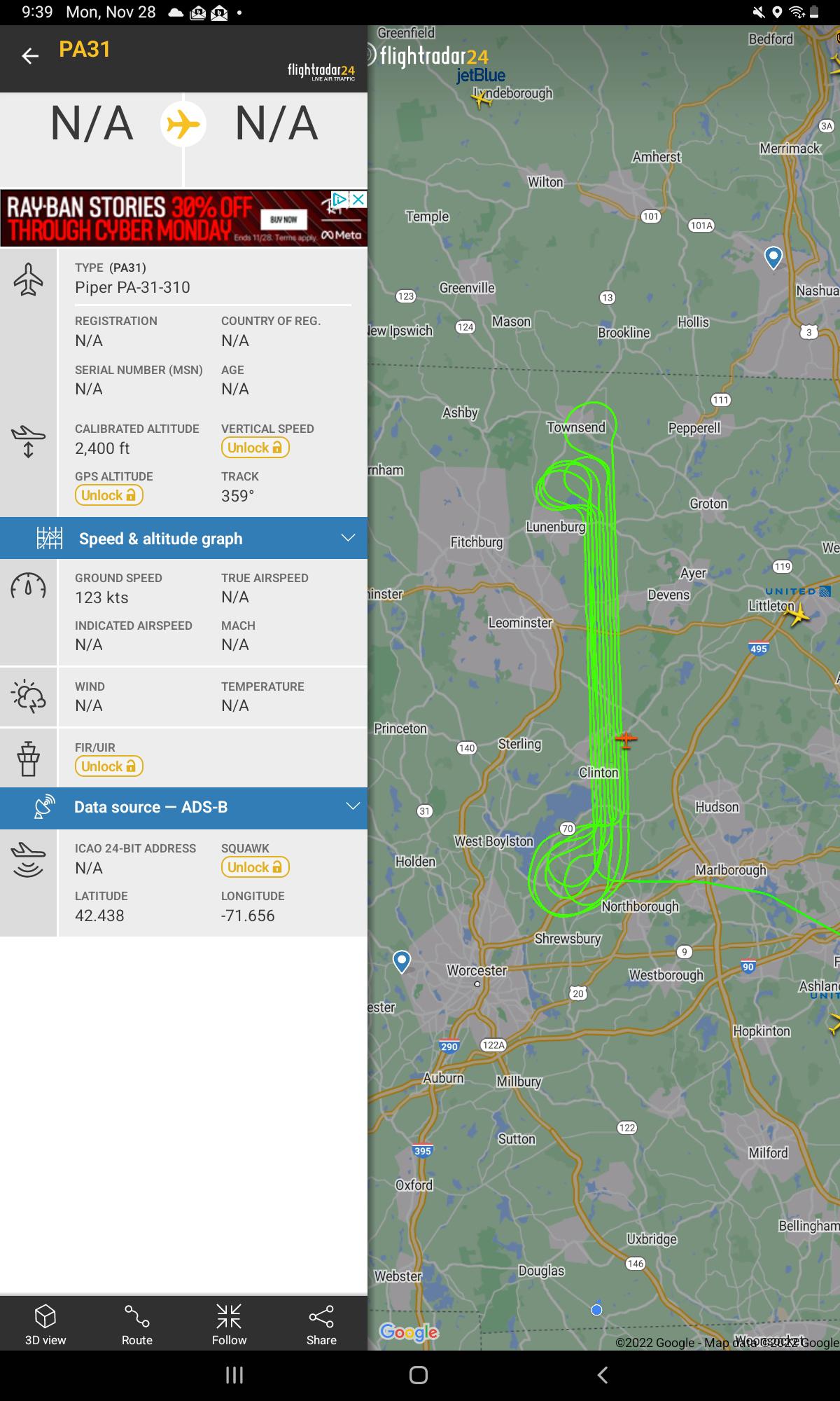
 what is this plane doing?
Submitted by baron_muchhumpin t3_z7gzsb in massachusetts
SEND-YOUR-PII t1_iy6xyvq wrote
Just a survey. Maybe LiDAR, maybe aerial imagery. Likely for an exceedingly boring thing, like an ortho photo provider updating imagery every few years.
SLEEyawnPY t1_iy8kgob wrote
One of the largest high-voltage transmission line networks in central MA runs approximately north-south just to the west of that flight path, so maybe surveying for the utility company. Seems too far away for doing direct inspection, which I think are usually done by helicopter
Viewing a single comment thread. View all comments